As wildfires become an increasing threat in California, the state relies on some of the world’s best firefighters to keep people and homes safe. That includes local resources like the Corona Fire Department (CFD).
“Corona Fire Department is involved in responding to large-scale wildfires up and down the entire state of California,” says Robert Peterson, a battalion chief at CFD. “As an incident commander, to be able to track my resources and the location of the fire is necessary for me to make good decisions, but also to keep my firefighters safe.”
For this mission-critical information, CFD leverages the ATAK platform on Samsung mobile devices.
Fighting Fire With Fire Data
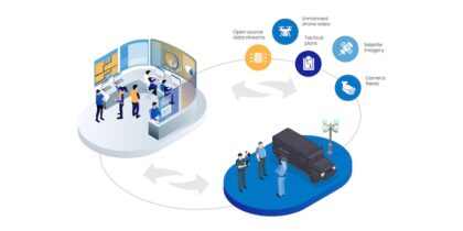
ATAK — short for Android Team Awareness Kit — is a geospatial collaboration tool developed by the Air Force Research Lab (AFRL) for special forces operators. It layers data from a variety of sources onto one map, which teams can view and edit in real-time to enhance situational awareness. The Department of Homeland Security (DHS) Science and Technology has civilianized the solution for local government agencies like CFD, which recently deployed the solution on Samsung Galaxy smartphones and tablets.
Enhance Response Capabilities With Smartwatches
Learn how a wearable form factor and advanced sensors offer unprecedented capabilities for first responders. Download Now
“Using ATAK and Samsung technology, we’re able to see in real-time where our firefighters are located,” says Peterson. “As an incident commander, that allows me to make better decisions on resources that I may need to call because I know where the fire progression is. It allows me to keep my crews safe. And we can use those locations of our people to gauge where the head of that fire is, so we can make determinations on evacuations, air and ground resources that we need to call to the scene to assist us.”
CFD also uses ATAK to improve situational awareness in other types of emergencies, including search and rescue missions. “We have a very active community that likes to hike in the Cleveland National Forest, and we frequently get injured or down hikers,” Peterson explains. “[We use] Samsung technology and cellphone GPS coordinates to locate an approximate location of the hiker. Once we’re able to dial that in on our Samsung devices, I can direct crews to start hiking towards that down hiker. We also use drone technology, where we can stream back that footage to [the ATAK platform on] our Samsung devices to locate that down hiker. Not only can my team in the field see that drone footage, but I can see it back at my incident command post. That’s a force multiplier when you’re searching in a large, wide-open space. It is greatly increasing our efficiency to get help to that person.”
Choosing Devices for ATAK
ATAK runs on any Android device, but CFD didn’t want just any smartphone running such vital software.
“When we started testing ATAK on multiple devices, we considered Samsung as one of the leaders due to the fact that they’re very reliable,” says Mike Leckliter, a firefighter and technical specialist at CFD. “They have long battery life. They have an ultra-bright screen and fast processors. Additionally, they’re user-friendly as a device administrator.”
Brian Young, fire chief at CFD, adds, “The ability for us to use Samsung in support of the ATAK platform is going to be a significant positive impact to our ability to do our job on a daily basis. Having that situational awareness and knowing where our resources are at all times is critical to our raw success.”
Discover the various mobile solutions that improve situational awareness and communication for first responders.
