Situational awareness is a crucial component of any mission. From blue force tracking to civilian search and rescue, effective, real-time decision-making requires an accurate understanding of what is happening in proximity to personnel in the field. Today, the intelligence, surveillance and reconnaissance (ISR) capabilities that create and maintain that operational picture are undergoing a rapid transformation that will bring both opportunities and challenges. New developments in drones, sensors and autonomous technologies are creating unprecedented visibility across all domains – and unprecedented amounts of data to ingest, analyze and deliver.
The increasing use of unmanned systems has significantly expanded the ability to gather intelligence in support of situational awareness objectives. These systems deliver ISR capabilities without putting humans in harm’s way. While unmanned systems have long been a part of military operations, improved technology and reduced system costs have made them increasingly accessible to civilian operators. Drones, specifically unmanned aerial vehicles (UAVs) and unmanned underwater vehicles (UUVs), as well as unmanned ground systems, improve situational awareness across homeland security and federal law enforcement missions such as explosive ordnance disposal (EOD), federal investigations and enforcement operations, search and rescue, border protection and wildland firefighting.
Now, unmanned systems are evolving to become autonomous, delivering even more intelligence-gathering capabilities to achieve greater situational awareness.
Autonomous systems deliver persistent and accurate intelligence feeds and expand geographic coverage beyond what can be reasonably reached with manned systems. When combined with emerging artificial intelligence (AI) technologies, autonomous systems can automatically surface relevant data for further operator interrogation to eliminate blind spots and support real-time decision-making. In addition, automated systems can improve redundancy and fail-over without a human in the loop to ensure an uninterrupted common operating picture.
Whether set on a schedule for persistent surveillance or sent out on an as-needed basis, autonomous ISR technologies are a force multiplier that can exponentially increase intelligence-gathering capabilities for any mission set. Given this potential, the adoption of autonomous ISR technologies is expected to be rapid. For example, the Department of Defense (DoD) is focusing the first stage of its Replicator initiative on the accelerated delivery of multiple thousands of all-domain attritable autonomous systems (ADA2) to warfighters across multiple domains by August 2025.
Autonomous technologies are a force – and data – multiplier
While the emergence of new ISR technologies is poised to greatly enhance situational awareness capabilities, the sheer amount of data it will bring creates a significant new challenge for both military and civilian operations. Without a reliable and effective platform to coordinate data collection, ingest findings, and deliver an actionable view of gathered intelligence, there is a risk that this new influx of data will only cloud the operational picture, not enhance it.
For autonomous drone technologies to tangibly improve mission outcomes through enhanced situational awareness, it is critical to reliably put the intelligence they gather into the hands of the people who need it most. Operators must be able to quickly and efficiently digest and share ISR data even in the kinds of challenging conditions that often accompany field operations.
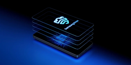
ATAK + Samsung deliver a clear view of the mission
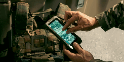
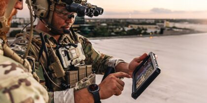
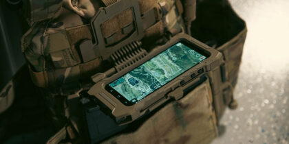
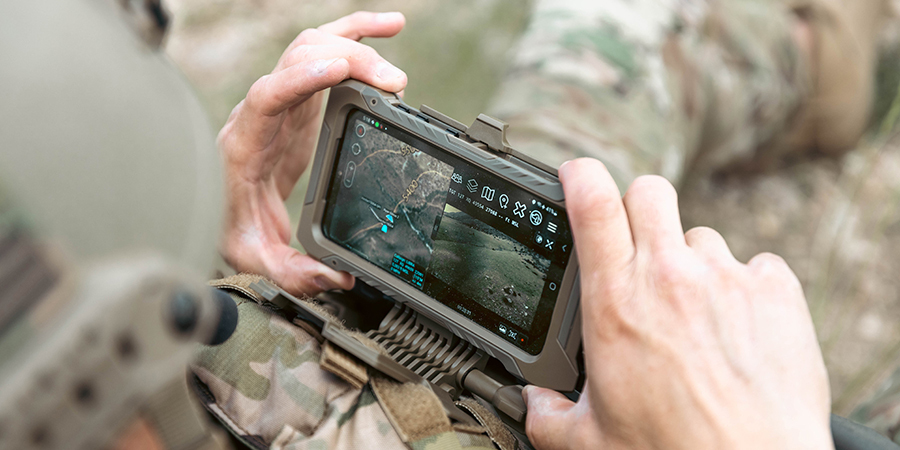
Samsung smartphones with Android Team Awareness Kit (ATAK) create the ideal platform to bring all of this intelligence together in a user-friendly way, no matter how it is gathered. GPS coordinates and video feeds from every drone, sensor and operator can be fed into a Samsung Galaxy phone with ATAK and overlaid onto maps so everyone involved in the mission has a real-time view of the situation they need to make decisions fast.
Military and civilian leaders have long trusted ATAK to provide a consolidated picture of the mission environment with precise locations of team members and assets. ATAK provides a secure and reliable platform to rapidly share data, images and video captured by drones or operators. It enables real-time collaboration across agencies and delivers an actionable operational picture to everyone who needs it. In fact, ATAK is by far the most widely used smartphone app for situational awareness for both civilian and military operations and benefits from years of research and development across numerous use cases. As an open, Android-based platform, ATAK offers interoperability, easy customization and streamlined plug-in development, resulting in a rich ecosystem of capabilities from collaborative, real-time mapping to radio signal integration to 3D modeling. Adding autonomous ISR systems to this ecosystem is a natural next step and will help ensure that the data they provide is delivered to the right people at the right time to drive positive mission outcomes.
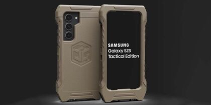
Samsung has a proven history of supporting the ATAK ecosystem. Our portfolio of mobile devices is ideally designed to meet the rapidly evolving situational awareness needs of military and civilian mission sets, including the accelerated adoption of autonomous technologies. Samsung mobile devices connect seamlessly with tactical radios and mission systems and provide the right mix of durability, security, functionality and processing power needed to deliver the common operating picture that military and civilian field operations require. This includes highly accurate GPS chipsets1 to support precise mapping of an operational area and the personnel and assets involved in the mission. Rugged device options are available to ensure operators can access data and communicate in all types of conditions. Plugins for wearables allow for monitoring of location and sensor data when the smartphone is in the pocket or pack. Further, Samsung Knox enables the secure transmission of encrypted data communications using ATAK, including text, mapping files, photos and video.
With autonomous systems and ATAK, the future is more visible than ever
Situational awareness is one of the most essential elements of successful military and civilian field operations. With the advent of autonomous ISR systems, situational awareness will become more accessible, persistent, accurate and intelligent. Samsung devices with ATAK are ready to help federal agencies unlock these new capabilities to provide a clear and collaborative view of any situation.
Learn how the Galaxy ecosystem empowers operators with persistent communications and situational awareness across domains.
1Dual GNSS GPS capability on Samsung Galaxy Tactical Edition smartphones provides refined position accuracy. GPS accuracy may be affected by weather, atmosphere, and other obstructions